GRASSROOTS INPUT TO ENVIRONMENTAL DEBATES
Going with the flow of the Dunham River
Upper Dunham River water catchment
 |
 |
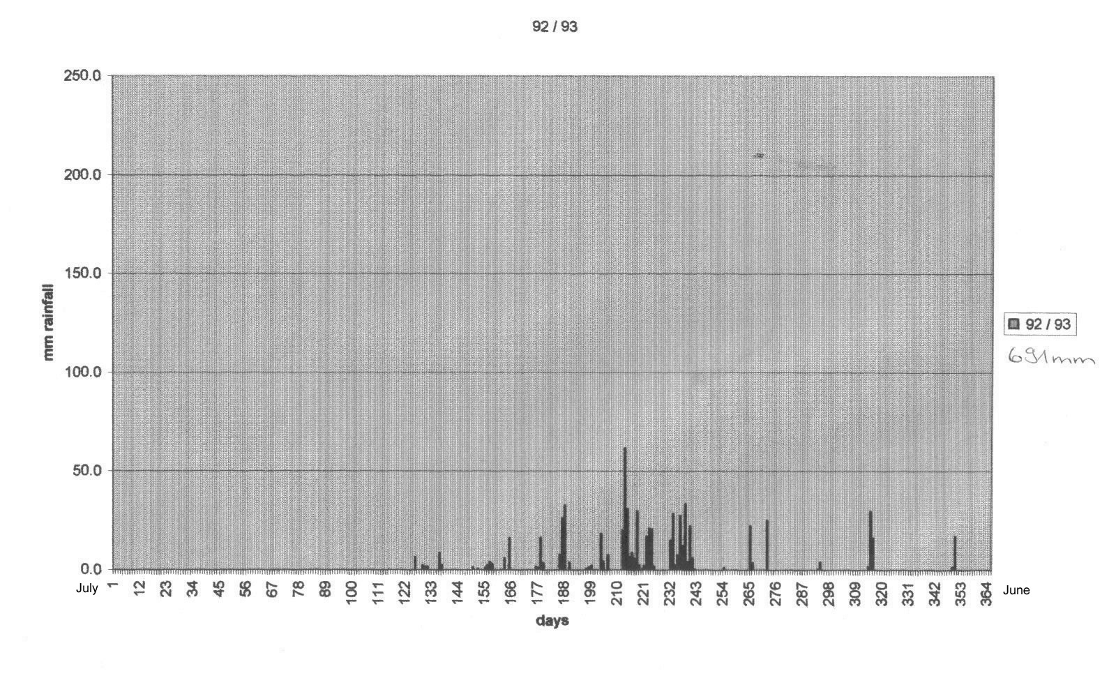
| This area has seen no rain since mid April2003. The 2002/2003 wet-season delivered about 675 mm of rain in the upper catchment area; this was a little below what could be expected and about half of what came down from the sky the year before. It is therefore no surprise that after the fire lit here in September 2003 there is little to burn off this year. | |
 The smoke is from fires used as a “cattle-mustering tool”. Bare ground makes cattle easier to spot and easier to shift with the use of ground vehicles or with helicopters.
 |
 Fresh “green pick” along watercourses (as an immediate result of fire) will cause cattle numbers to congregate. It is then easier to keep them together by moving them along watercourses with no vegetation where they can hide. Stress on livestock and mustering costs are reduced.
 |
 Both the intensity and the frequency of human lit fires over time are a significant
factor in the shaping of a landscape. At this time of the year a fire will make its
own wind to propel itself forward. Provided the fuel load is there, it will keep
on burning until it runs out of fuel.
Both the intensity and the frequency of human lit fires over time are a significant
factor in the shaping of a landscape. At this time of the year a fire will make its
own wind to propel itself forward. Provided the fuel load is there, it will keep
on burning until it runs out of fuel. |
 This area no longer supports the type of fire patterns that were obvious from the air ten years ago.
 |
 |
|
|
|
Lower Dunham River water catchment: | |
 In the picture above the arrows indicate where clumps of forest/wetland areas were lost
in recent decades. Originally perennially flowing streams are now dry gullies. Fortunately
this trend can be reversed; however this will depend on communication, education and
appropriate action.
In the picture above the arrows indicate where clumps of forest/wetland areas were lost
in recent decades. Originally perennially flowing streams are now dry gullies. Fortunately
this trend can be reversed; however this will depend on communication, education and
appropriate action. |
 In the lower catchment areas many large “water holes” are now full of sand. In the lower catchment areas many large “water holes” are now full of sand. |
As many landscape-rehabilitation and landscape-revitalisation processes do not immediately contribute to any commercial activity these sort of issues can only be addressed once either the threat of flooding becomes apparent to down-stream communities or if society begins to place a monitory value on healthy functional landscapes.
 Flying Fox Yard: Physical infrastructure is threatened by both erosion and flooding whilst the source of reliable water is sanding up. Flying Fox Yard: Physical infrastructure is threatened by both erosion and flooding whilst the source of reliable water is sanding up. |
 Gully-erosion (marked by the mowed track around the perimeter – bottom left hand side of the picture above) has not progressed in recent years. This is because the choking up of drainage lines immediately down-stream has slowed the draining of floodwaters; actual gullies are under water during a flood and no further local erosion occurs. Gully-erosion (marked by the mowed track around the perimeter – bottom left hand side of the picture above) has not progressed in recent years. This is because the choking up of drainage lines immediately down-stream has slowed the draining of floodwaters; actual gullies are under water during a flood and no further local erosion occurs. |
 | |
|
|
 |
|
| In most years an eroding Western riverbank makes room for the wet-season flow. | |
Ord | |
 “Looking upstream”: A vast and rugged setting can easily distract us from noticing subtle (and sometimes not so subtle) changes in our landscapes. “Looking upstream”: A vast and rugged setting can easily distract us from noticing subtle (and sometimes not so subtle) changes in our landscapes. |
 Statements like “fire is natural” can also be a distraction. Statements like “fire is natural” can also be a distraction. |
 A human made wetland habitat being subjected to fire: in this case a natural physical force/disturbance unleashed by humans. What is the net effect on biodiversity of these prevailing practices? A human made wetland habitat being subjected to fire: in this case a natural physical force/disturbance unleashed by humans. What is the net effect on biodiversity of these prevailing practices? |
 No doubt “time” will be the fairest judge of the benefits of current landscape management. No doubt “time” will be the fairest judge of the benefits of current landscape management. |
top
|
Last modified: October 22 2019 23:26:08. |
![]() print this page
print this page